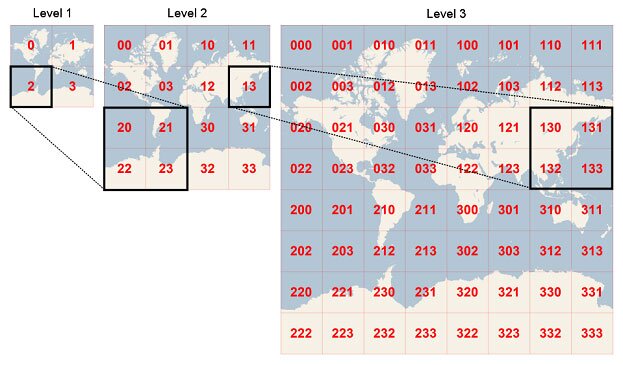
🗺️ Geohashing is a method used to encode geographical coordinates into a shorter text string, which can then be used to represent the location and perform approximate distance calculations between points. This technique is often employed in applications like location-based services, map visualization, and data compression.
Notes
Info
Geohashing: A system for encoding geographic coordinates into a string of characters.
Invented by Gustavo Niemeyer in 2008, Geohashing uses a base32 alphabet to represent latitude and longitude values. By applying a recursive algorithm, it generates a consistent length string that approximates the location. The precision of geohashes can be adjusted by altering the number of characters in the output string.
TakeAways
- 📌 Geohashing provides a concise representation of locations for various applications and distance calculations
- 💡 Adjustable precision allows trading off accuracy for shorter strings; base32 alphabet ensures unique encodings within the same precision level
Thoughts
- 📈 Growing Importance: Geohashing is increasingly relevant for location-based services, data compression, and map visualization
- 🔬 Future Directions: Research focuses on optimizing algorithms, exploring alternative encoding methods, and improving precision-accuracy tradeoffs